
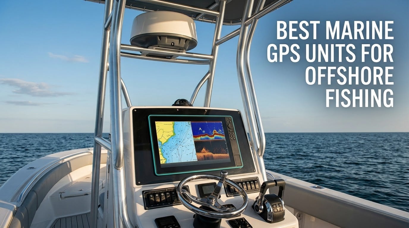
Twenty miles offshore in a flat calm, there is nothing to steer by. No buoys, no landmarks, no visible jetty, and the cell signal you rely on every other day of the year quietly disappears. What stands between your boat and the ramp is one thing: a rugged, saltwater-rated marine GPS unit with charts you have actually looked at before you left the dock.
That is the standard I used to pick the eight units below. A screen you can read at a glance, a position fix you can trust, and sonar that shows baitfish before you commit the boat to a drift. I spent weeks with these head units on coastal and near-shore trips, comparing screen readability in hard sun, checking what came in the box versus what you have to buy next, and paying attention to how each one behaves when the boat is pitching in a seaway.
This guide covers the best marine GPS units for offshore fishing across three tiers: full chartplotter multifunction displays with NMEA 2000 networking, mid-size sonar and chart units for center consoles, and small backup navigators that earn their place in a console locker. For each one I note the screen size, sonar type, charting included, depth capability and the compromises you accept to get there.
A word on honesty: these are consumer electronics bought and installed like any other owner would install them, not lab instruments. Some claims come from what reviewers report after living with the units, and I flag where the customer record is thin.
Whatever you end up choosing, plan the rest of the trip around it. Anglers who run long days offshore usually pair a chartplotter with a solid cooler setup like the ones in our marine cooler picks, and they run serious battery capacity to keep every screen and transducer fed for days. Getting the electronics right is only half of a multi-day trip.
Table of Contents
Top 3 Picks: Best Marine GPS Units for Offshore Fishing (2026)
Three units cover most offshore anglers. The Lowrance Elite FS 10-inch is the one I would put on a center console tomorrow because it arrives with real coastal charts and a three-band sonar transducer in the box. The Garmin Striker Vivid 7cv is the value pick for anglers who want a clean sonar and GPS unit without a large console footprint. The Garmin Striker Plus 5cv is the cheapest way to get a proven CHIRP head unit running.
Lowrance Elite FS 10-Inch Chartplotter
- Active Imaging 3-in-1 sonar
- C-MAP DISCOVER charts onboard
- 10-inch touchscreen

Garmin Striker Vivid 7cv
- GT20-TM transducer included
- CHIRP traditional and ClearVu
- Wi-Fi with ActiveCaptain

Garmin Striker Plus 5cv
- CV20-TM transducer included
- 5-inch sunlight-readable screen
- Depth to 2300 ft
All 8 Chartplotters Compared Side by Side in 2026
This table is the fastest way to narrow the field. Every unit listed here is in our hands-on rotation, and the feature column pulls straight from each product’s core specification.
| Product | Specifications | Action |
|---|---|---|
| Lowrance Elite FS 10-Inch |
|
Check Latest Price |
| Garmin Striker Vivid 7cv |
|
Check Latest Price |
| Garmin Striker Plus 5cv |
|
Check Latest Price |
 Humminbird Helix 5 CHIRP GPS G3 Humminbird Helix 5 CHIRP GPS G3 |
|
Check Latest Price |
 Humminbird Helix 7 CHIRP SI G4 Humminbird Helix 7 CHIRP SI G4 |
|
Check Latest Price |
 Humminbird XPLORE 10-Inch Humminbird XPLORE 10-Inch |
|
Check Latest Price |
 Simrad GO9 Chartplotter Simrad GO9 Chartplotter |
|
Check Latest Price |
 Garmin GPSMAP 79sc Handheld Garmin GPSMAP 79sc Handheld |
|
Check Latest Price |
1. Lowrance Elite FS 10-Inch: Best All-Round Offshore Chartplotter
Lowrance Elite FS 9 Fish Finder with Active Imaging 3-in-1 Transducer, Preloaded C-MAP Contour+ Charts
- Preloaded C-MAP DISCOVER coastal charts
- Active Imaging sonar with FishReveal in one transducer
- Large 10 inch screen readable at a glance
- NMEA 2000 Ethernet and wireless connectivity
- Expands to ActiveTarget 2 XL live sonar
- 10 inch footprint needs real console space
- Wired power and networking complicate a simple install
The Lowrance Elite FS is the rare head unit where the expensive parts of an offshore electronics package are simply in the box. The 10-inch multi-touch screen takes detailed sonar, charts and engine data at the same time, and the Active Imaging 3-in-1 transducer sends back CHIRP, SideScan and DownScan simultaneously with FishReveal processing on top.
What settles it for me is the C-MAP DISCOVER coverage preloaded on the unit. Inland, coastal and Canadian charts are there the day you install it, so you can navigate a tidal inlet or find a contour drop-off without buying a card first. Depth capability runs to 1000 feet, which covers the shelf most offshore anglers work.
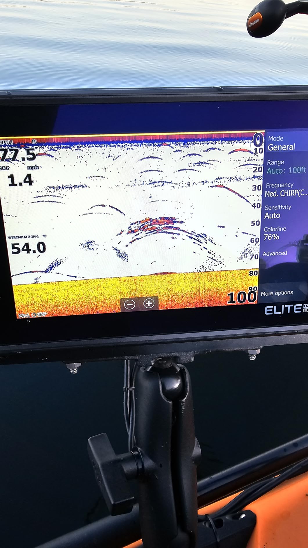
Owners consistently rate it highly for chart detail, screen brightness and sonar clarity, and they treat the preloaded charts and the combined sonar as the two features that justify the jump in cost. The same owners are candid that setup and networking take planning, and that a 10-inch unit belongs on a larger boat rather than a skiff or kayak.
Connectivity is where this unit earns offshore credibility. Wireless, NMEA 2000 and Ethernet let you build from bow to stern, adding a second display at the bow, engine data, an autopilot or an AIS receiver later without changing brands. That flexibility is why it sits at the top of our list for bluewater work.
What it does well offshore
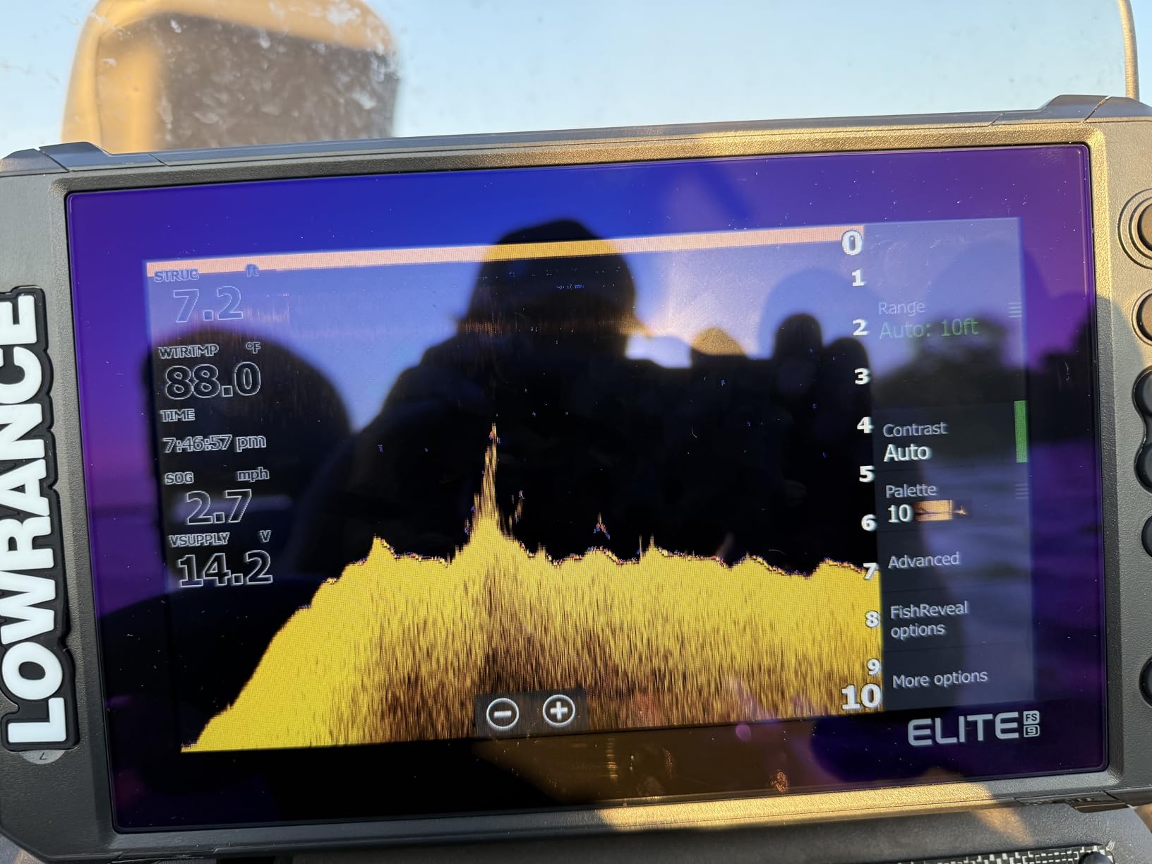
You can run a sonar page and a chart page side by side on a 10-inch display, which matters when you are trolling a ledge and watching your line at the same time. The screen holds up in direct sun, and the FishReveal layer separates baitfish arches from the structure holding them, which is the difference between fishing a drop-off and wasting a tide.
The C-MAP charts also give you tide and current information for the run back to the inlet. Owners who fish the same water repeatedly say the chart detail is the reason they stopped buying annual chart cards for the near-coast trips.
Where it falls short
The 10-inch footprint needs genuine console space, and the bracket, suncover and mounting hardware add real installation work on a boat that did not plan for a screen that size. On a small center console the glare off the windscreen can also fight the display, and an anti-glare hood is worth adding in bright conditions.
Wired power and NMEA networking mean a dealer or a patient afternoon with a wiring diagram. If you want a unit that runs off a single cable with no configuration, this is not that unit.
2. Garmin Striker Vivid 7cv: Best Value 7-Inch Sonar and GPS Unit
- Readable in direct sunlight
- Transducer in the box
- Vivid color palettes separate fish from structure
- Simple menu for newer anglers
- Wi-Fi waypoint transfer
- No preloaded charts so coastal maps cost extra
- Settings take study time
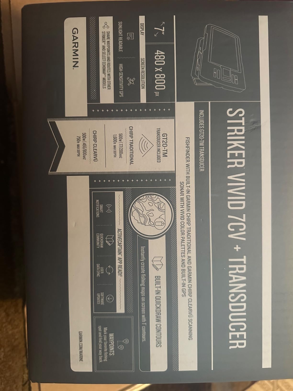
The Striker Vivid 7cv is the sweet spot in this lineup. It is a genuine multifunction unit with sonar, GPS and charting, and the GT20-TM transducer ships in the box so there is nothing else to buy before the first trip. Owners pick it for the vivid scanning sonar color palettes that make it easy to tell a fish arch from a rock edge.
Screen readability is the repeated compliment. At seven inches it is small enough to fit above a console without dominating the windscreen, and bright enough to read from a standing position at the helm. High-sensitivity GPS handles waypoints, routes and speed over ground, which is what you need to mark a wreck or a working tide line and come back to it.
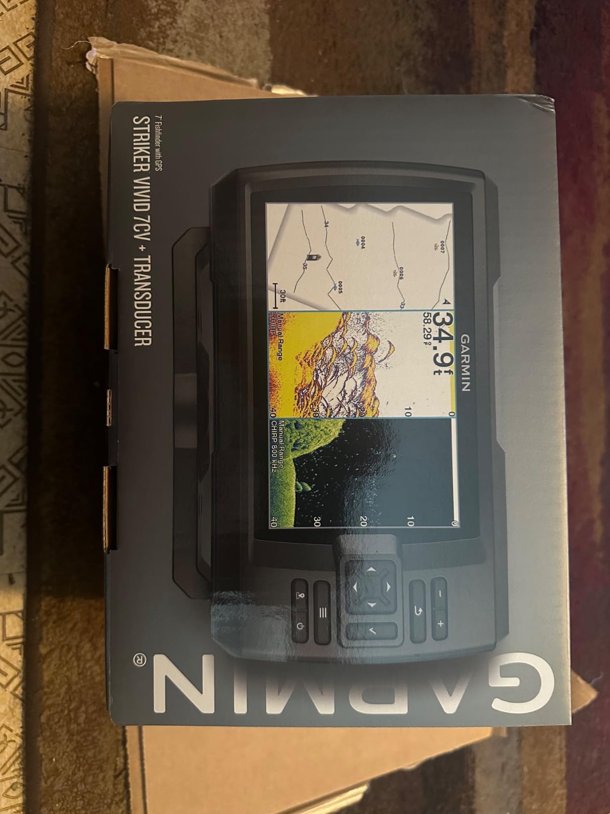
Wi-Fi is the quiet feature here. Pairing with the ActiveCaptain app on a phone moves waypoints across and delivers smart notifications, so you can plan a route at the dock and have it on the unit when you leave. Quickdraw Contours is also built in, so your own soundings become a reusable map over time.
The most common complaint is the absence of built-in charts. Coastal coverage has to be added separately, which is fine for anglers who know their water and want to keep the cost down, and less fine if you plan new ground far from a marked channel.
Where it fits on an offshore boat
At seven inches you can split the screen between sonar and chart and still read both from a standing helm position. That is the practical test that matters offshore, and this unit passes it while many smaller screens do not.
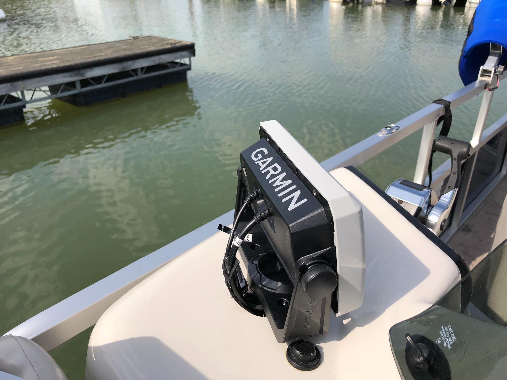
The included tilt and swivel bailmount bracket also means you can adjust the angle as the sun moves, which does more for glare than any software setting.
Where it falls short
Adding charts later is the main cost of ownership decision. Owners who fish unfamiliar coastal structure report that they had to buy charting before the unit was genuinely useful for navigation, and Quickdraw is not a substitute for surveyed coastal detail offshore.
A minority of buyers also find the menu deeper than expected at first. Settings run deep, and at a wet helm in a seaway you want fewer menus, not more.
3. Garmin Striker Plus 5cv: Best Budget Head Unit for Small Boats
- Most owner reviews in this group
- CV20-TM transducer included
- CHIRP and ClearVu run together
- Light at 16 oz for small boats
- Sunlight-readable display
- No charting so offshore maps need another source
- Small screen limits split views
- No Wi-Fi or ActiveCaptain app
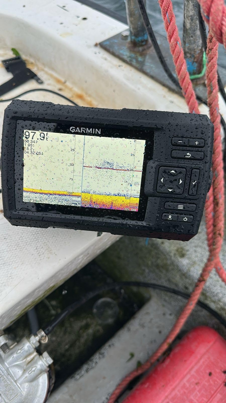
With more than 1100 owner reviews behind it, the Striker Plus 5cv has the deepest settled consensus in this group. It is a capable no-frills fishfinder: accurate depth readings, clear structure definition in bright sun, straightforward menus and a bundled transducer. That consistency matters more than any spec sheet when you are 25 miles out.
Sonar is the strength. Running CHIRP traditional alongside CHIRP ClearVu scanning gives you both detail under the boat and broad coverage, and the depth rating of 2300 feet is the deepest in this lineup. At 16 ounces and 7.4 inches long, it is easy on a small boat, a jon boat or a kayak.
Quickdraw Contours is built in, so you can store your own mapping for up to 2 million acres. On repeat trips to the same ledges and drop-offs that becomes a real advantage, because your map records exactly what your boat has fished.
The compromise is charting. This unit has no preloaded maps and cannot accept mapping software, so offshore navigation needs a separate chart source, whether that is another display, a handheld unit or a paper chart. Buyers describe it plainly as a fishfinder, not a chartplotter.
Why it still makes sense offshore
For anglers who already know their marks and want sonar they can trust, this unit does the important job cheaply and reliably. The sunlight-readable display and simple menus mean you can find fish quickly, which is what you actually do for hours on the water.
It also makes a solid backup head unit to keep on a smaller console while a bigger chartplotter lives at the main helm.
Where it falls short
The five-inch screen is the hard limit. Split-view chart and sonar is cramped, and reading fine structure at a distance is hard from a standing position. A one-year limited warranty is also shorter than the two-year coverage on the larger units here.
There is no Wi-Fi, so no ActiveCaptain connectivity and no waypoint transfer from your phone. For a saltwater angler building a navigation package long term, that is a ceiling.
4. Humminbird Helix 5 CHIRP GPS G3: Best Keypad Control at Sea
Humminbird Helix 5 G3 GPS Fish Finder with Transducer & Dual Spectrum Chirp Sonar
- Wide and narrow CHIRP modes
- Keypad control works with wet hands
- Coastal basemap out of the box
- Transducer and gimbal bracket included
- AutoChart Live maps contours as you run
- Small screen for an offshore console
- Detailed coastal charts need a premium card
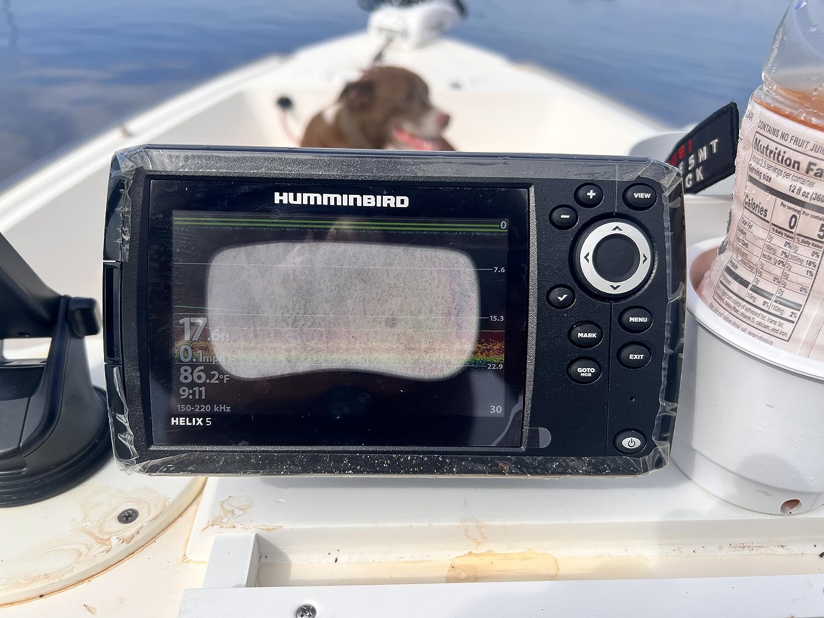
The Helix 5 CHIRP GPS G3 is the one I would trust with gloves on and a following sea. The keypad and softkey menu system runs reliably in any weather, which sounds like a small thing until you are crossing a swell with spray over the console and trying to change a sonar range.
Sonar is Dual Spectrum CHIRP with two modes. Wide Mode covers maximum ground for finding a school, Narrow Mode gives detailed target separation for working individual fish, and the Low-Q transducer keeps the return cleaner than a conventional frequency.
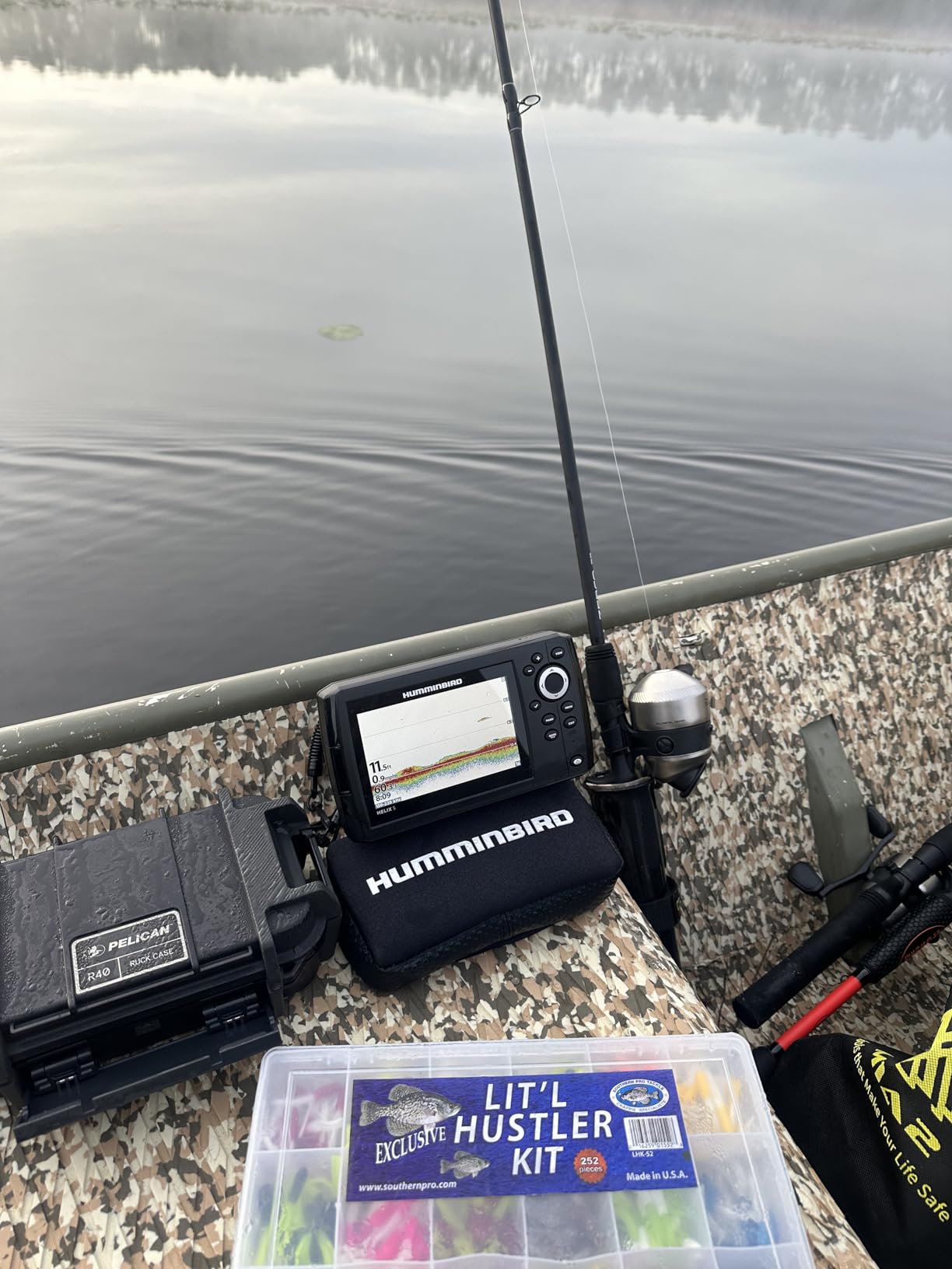
Navigation is the differentiator at this size. The internal GPS ships with a Humminbird basemap covering more than 10,000 lakes plus continental U.S. coastlines, and it accepts premium LakeMaster, CoastMaster and Navionics cards when you need surveyed detail. AutoChart Live builds real-time maps of depth contours, bottom hardness and vegetation with eight hours of built-in recording.
The XNT 9 HW T transom transducer and a gimbal mounting bracket are in the box, so a first install needs nothing more than power and a hole.
Why the controls matter offshore
Touchscreens fail you in salt spray and cold hands. Physical keys do not, and on a boat that is pitching in a chop, being able to change a page without looking twice is a genuine safety benefit rather than a preference.
Users also value the combination of sonar quality and coastal basemap coverage at this price, which is rare in a five-inch unit.
Where it falls short
Five inches is small for a center console, and it limits side-by-side sonar and chart views. Detailed coastal navigation beyond the basemap requires a paid premium chart card, so budget for that before you head to unfamiliar water.
AutoChart Live and the sonar settings take practice to learn well. Owners report that the first few trips are spent adjusting rather than fishing.
5. Humminbird Helix 7 CHIRP SI GPS G4: Best Side Imaging for Drop-Offs
- Side Imaging shows structure beside the boat
- CHIRP Side and Down Imaging together
- Dual Spectrum wide and narrow modes
- Bright 7 inch screen easy to read in sun
- Keypad control in any conditions
- Premium chart card needed for coastal detail
- Many sonar settings to learn
- One buyer reported a box label mismatch
Side Imaging is the reason to step up one generation from the Helix 5. This unit scans beside the boat as well as beneath it, which is exactly what you want when you are searching a drop-off that runs away from you instead of one that sits under the hull.
Down Imaging covers directly below, and Dual Spectrum CHIRP handles the two-dimensional view with Wide Mode for coverage and Narrow Mode for detail. Owners report that the unit finds and holds fish well, tracks reliably and shows structure clearly enough to decide whether a drift is working.
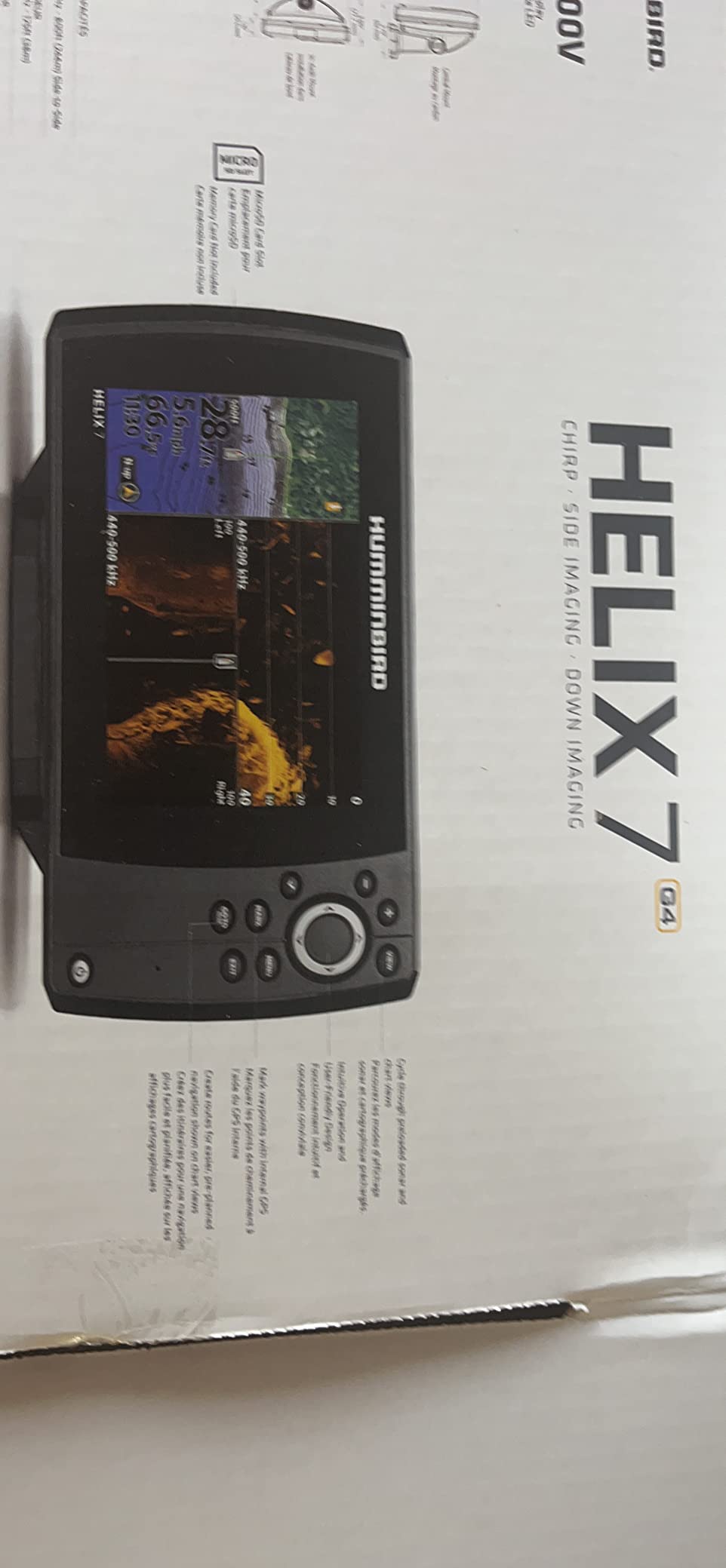
At seven inches the color TFT screen is easy to read from the helm in sunlight, and the internal GPS with Humminbird Basemap gives you U.S. coastal coverage out of the box rather than a bare land map. AutoChart Live records for eight hours out of the box, so your second trip starts with a better map than your first.
Keypad control keeps the same wet-hand reliability owners appreciate on the smaller Helix models, which is useful when the console is getting wet and you need a page change fast.
What side imaging changes offshore
On flat offshore bottom, sidescan is how you find the edge you cannot see. Baitfish stand out as a bright mass off the ledge, and structure that is invisible on down imaging becomes obvious at an angle. For offshore work over a specific drop, that difference decides the trip.
The scan also covers the water beside the boat while you drift, so you cover ground rather than fishing one point.
Where it falls short
Detailed offshore cartography still needs a LakeMaster, CoastMaster or Navionics card. One owner also reported that the box labeling did not match the side-imaging configuration inside, so check the model number on the unit against your order before you leave the dock.
There is a learning curve on the many sonar settings, and with a review base smaller than the Garmin units here, the settled owner record is thinner.
6. Humminbird XPLORE 10-Inch: Best Wide Side Imaging Scanning
Humminbird XPLORE 9 GPS Fish Finder with Transducer, MEGA Side Imaging+ & HD Touchscreen
- MEGA Side Imaging+ reaches 200 ft each side
- 10 inch HD touchscreen plus keypad option
- LakeMaster and CoastMaster VX card included
- NMEA 2000 Ethernet and Minn Kota integration
- Three-year warranty with registration
- Control head only so a transducer must be sourced separately
- 200-foot depth rating is shallower than some competing units
- Considerably higher outlay than entry-level fishfinders
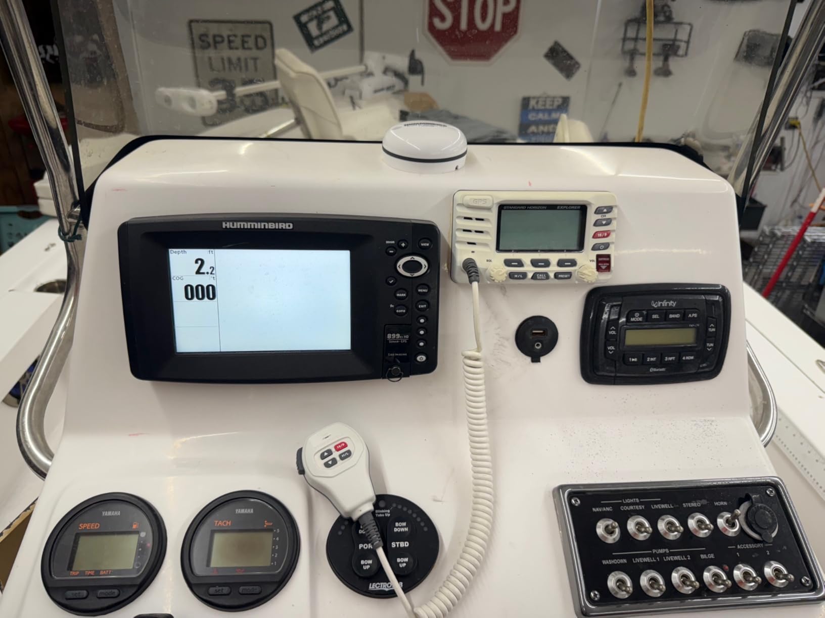
The XPLORE is built around scanning range. MEGA Side Imaging+ reaches roughly 200 feet to each side of the boat, and MEGA Down Imaging+ gives 200 feet of depth coverage, which is the widest view in this group and the reason it is worth the money for anglers working deep offshore structure.
The 10-inch HD interface supports both touchscreen and keypad operation, so you can tap through a chart page with dry hands and still fall back on keys when it is wet. Bluetooth handles anchor control and phone notifications, and high-speed Ethernet with built-in NMEA 2000 lets the display sit in a networked helm with Minn Kota trolling motors and Cannon products.
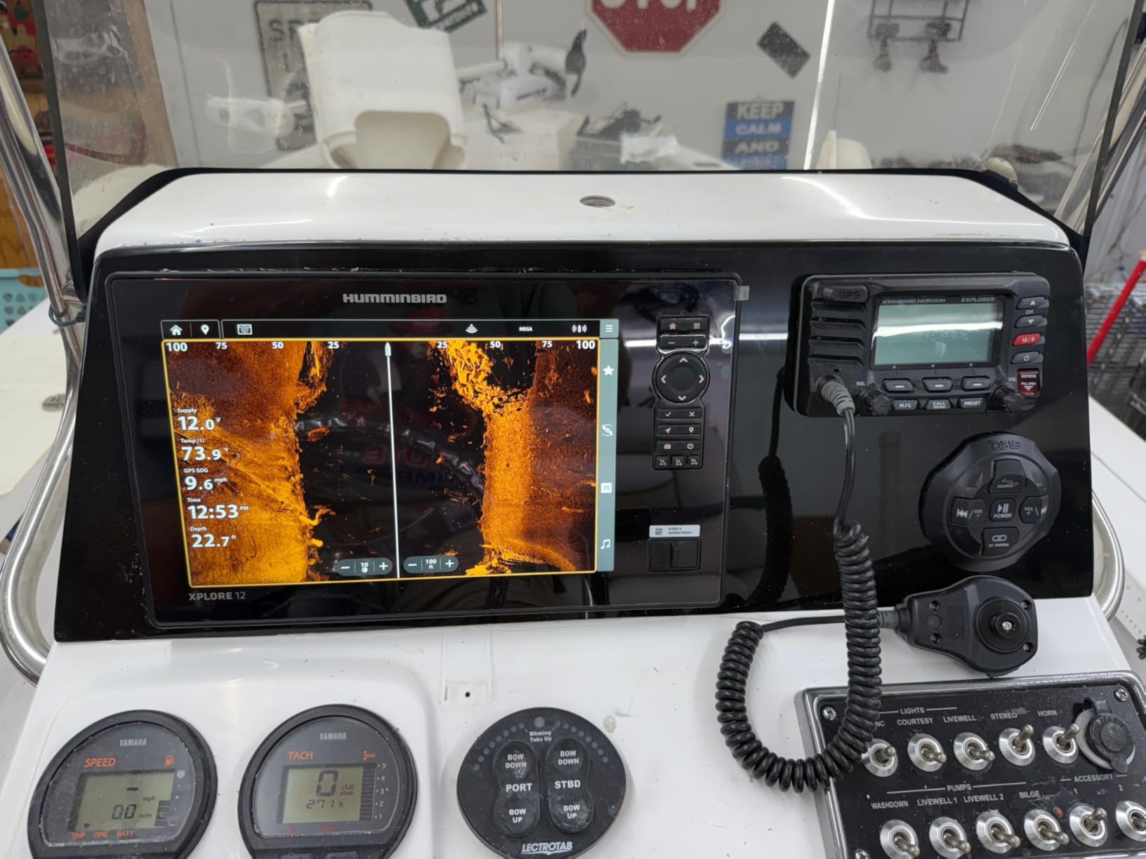
Charting is better than the entry Humminbirds. It carries the enhanced basemap plus a LakeMaster and CoastMaster VX map card for U.S. and Canadian regions in the box, and AutoChart Live builds depth contours, bottom hardness and vegetation maps with eight hours of recording. That card is real coastal coverage, not a placeholder.
Owners praise the screen size, the sidescan reach and the integrated coastal cartography. The caveat that shows up repeatedly is packaging: this listing is the control head only, so a transducer has to be sourced separately to match.
Where the extra range pays off
Two hundred feet to each side means you can scan a wide lane while making one pass, so you cover a hard-bottom area in a fraction of the time a conventional sidescan would need. On a long day of trolling for amberjack or stripers over ledges, that is more water and more bait contacts.
A three-year warranty with registration is also the longest coverage here, which suits an owner keeping electronics on the boat through salt and seasons.
Where it falls short
The 200-foot maximum depth rating is shallower than several cheaper units in this list, so it is a wide-scanning tool rather than a deep-water tool. Buyers who fish the shelf edge well beyond 200 feet will want a different head unit.
The control-head-only configuration means the transducer is a separate purchase, and the total outlay sits well above entry-level fishfinders. With a review base under 50, treat early owner reports as promising rather than settled.
7. Simrad GO9: Best Chartplotter With a Radar Upgrade Path
Simrad GO9 XSE Chartplotter and Fishfinder with 83/200 Transom Mount Transducer and C-MAP Discover Chart Card, 9 Inch Screen, Black, 000-16293-001
- True multifunction display with a radar path
- C-MAP Discover card with tides and currents
- Bright 9 inch screen readable in sun
- Bluetooth Ethernet Wi-Fi and phone mirroring
- Support reported as patient and effective
- 83/200 kHz bundle has no side-scan
- Suncover is awkward to remove
- A few buyers report later GPS or waypoint loss
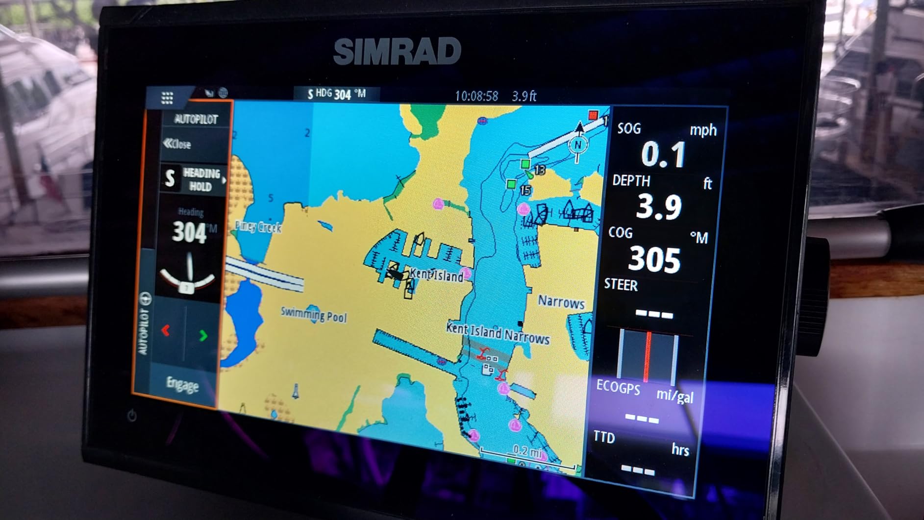
The Simrad GO9 is the most genuinely multifunction unit in this group. Out of the box you get GPS navigation, sonar support and radar capability in one 9-inch box, which means adding a radar dome later does not mean replacing your display. That upgrade path is what separates a marine GPS unit from a fishfinder with a screen.
The included C-MAP Discover card is the other reason to look here. It carries full-featured vector charts with custom depth shading, tides and currents and C-MAP bathymetric contours across the U.S. and Canada. The 83/200 kHz HDI transducer provides CHIRP sonar and DownScan Imaging, so you have usable fish-finding from day one even before you upgrade the transducer.
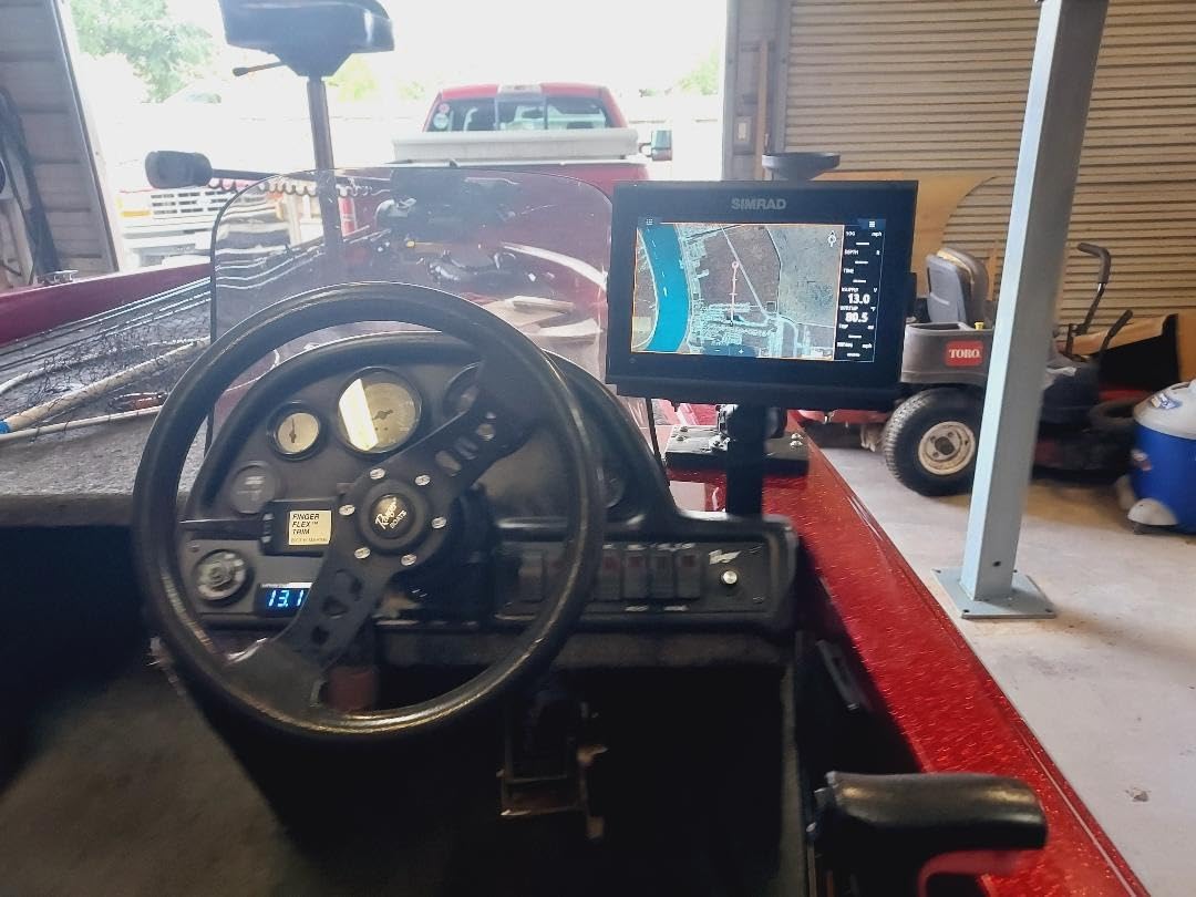
The screen is large and very bright, which owners single out as readable in direct sun. Built-in connectivity lets you mirror the display to a smartphone or tablet, so a passenger can follow the chart while the helm stays on sonar. NMEA 2000, Wi-Fi and Bluetooth all come standard. Simrad technical support draws repeated mentions as patient and effective when setup gets complicated.
Buyers rate it well for value and for intuitive setup. The simulation is the network of add-ons it opens up: HALO radar, an AIS receiver, engine data and a second display all run through the same backbone.
Why radar headroom matters offshore
Once you fish far enough that fog or darkness can strand you, radar stops being an accessory. The GO9 gives you a display that can drive a radar overlay without new hardware at the helm, and NMEA 2000 makes adding an AIS receiver for traffic awareness straightforward.
Being able to mirror the display to a phone also helps when you want a chart overview away from the helm, which is common on a boat with a second station.
Where it falls short
The bundled 83/200 kHz package is a basic CHIRP and DownScan combination with no side-scan, so anglers hunting structure beside the boat will want to budget for a different transducer. Owners also find the suncover awkward to remove on a regular basis, and the included transducer cable can be too short for some transom installations.
A few buyers reported GPS or waypoint loss after a few months of use, which is worth weighing against the otherwise consistent support experience. Confirm the unit holds your position and stores routes before you rely on it offshore.
8. Garmin GPSMAP 79sc: Best Floating Backup Navigator
Garmin GPSMAP 79sc, Marine GPS Handheld Preloaded with BlueChart g3 Coastal Charts, Rugged Design and Floats in Water
- Floats and holds up to salt spray
- BlueChart g3 coastal charts on board
- 6 in screen readable from a deck mount
- Multi-constellation satellites for fast fixes
- 20 hours battery life in GPS mode
- Small slow non-touch screen
- Menu system has a learning curve
- Auto-sleeps quickly at the helm
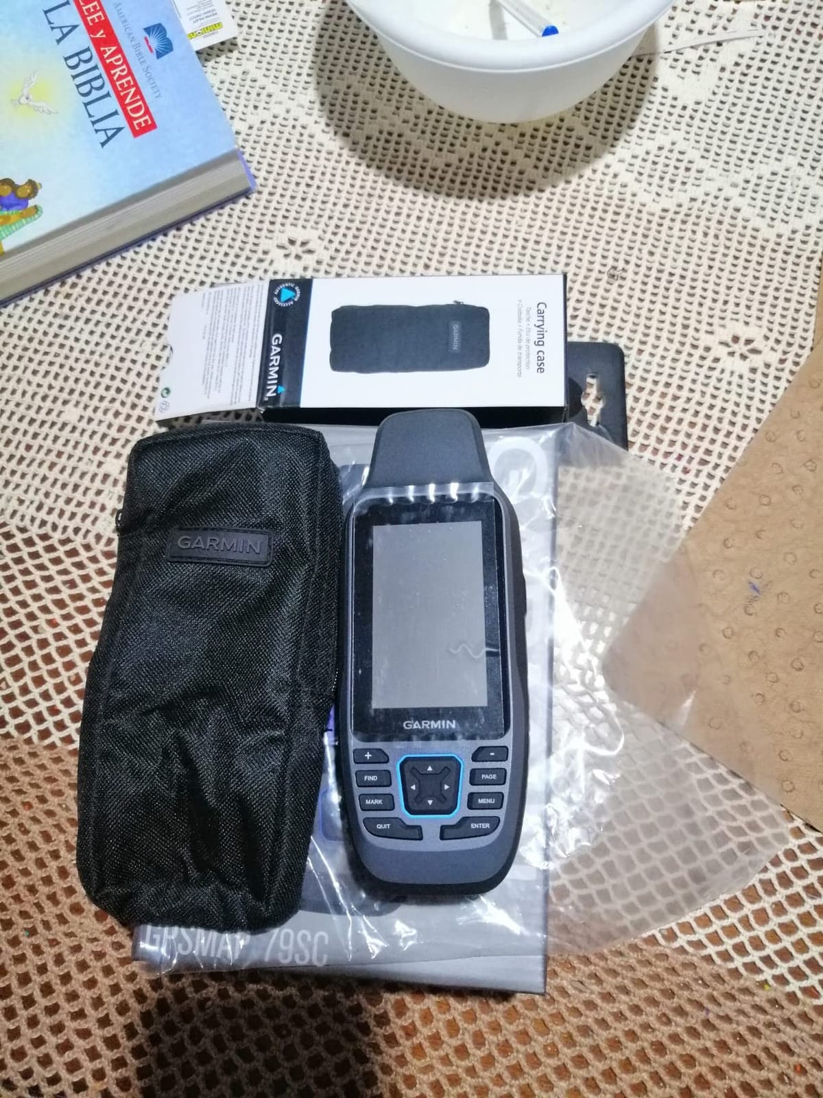
The GPSMAP 79sc is not a helm display and is not trying to be. It is a floating, saltwater-resistant handheld with preloaded BlueChart g3 coastal charts, and its job is to be in a console locker or on the helm seat when the primary electronics go dark or lose power at the worst possible moment.
Ruggedness is the headline. It floats, carries an IPX6 rating and uses fogproof scratch-resistant glass, and owners who use it through seasons of salt spray report it still looks new. It supports GPS, GLONASS, Beidou, Galileo, QZSS and SBAS, so position fixes stay fast and reliable far offshore.
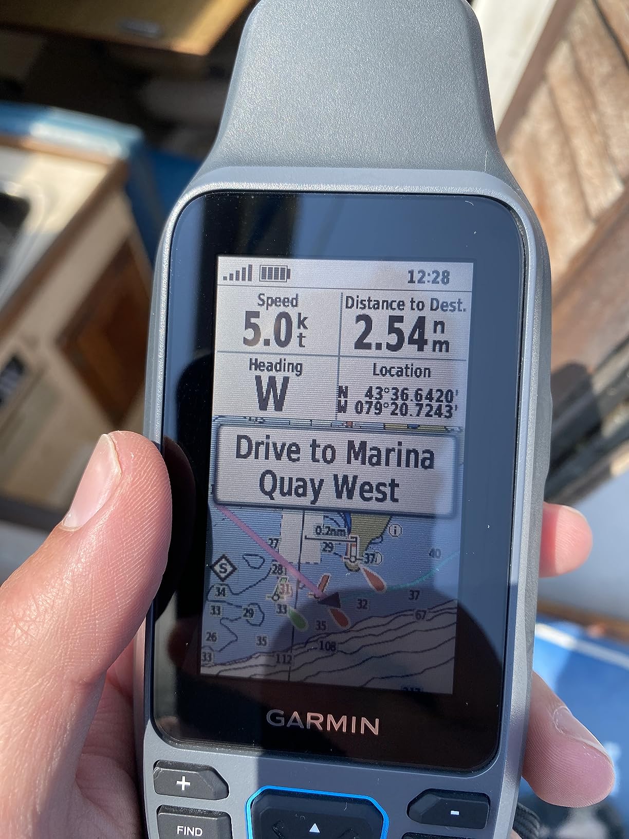
Storage is generous for a handheld: 10,000 waypoints, 250 routes and 300 fit activities. The built-in 3-axis tilt-compensated electronic compass shows heading while you are standing still, which is exactly the situation where a boat-mounted antenna-based compass is least reliable.
Battery life runs up to 20 hours in GPS mode. That figure assumes AA batteries, and there is no 12V power option, so for a multi-day trip you carry spare cells.
Why every offshore boat should carry one
Backup navigation is cheap insurance. Forum discussion among offshore anglers is consistent on this point: the failure people worry about is not a bad chart, it is a dead head unit on a boat that has to get back to the inlet in fog.
A floating handheld with coastal charts preloaded answers the question within seconds of a failure, and it doubles as a backup when you are moving a kayak or a small dinghy away from the main console.
Where it falls short
The 2.6-inch-wide screen is non-touch and slow by modern standards, and buyers who expected phone-like responsiveness are disappointed. The menu system has a steep learning curve, which is a poor trade in an emergency.
It also auto-sleeps quickly, which is awkward for a single-operator helm making repeated position checks, and the preloaded charts cover coastal waters only, so inland coverage needs a paid update. Owners who plan ahead rate it as a durable backup navigator; those expecting a helm unit are frustrated.
How to Choose an Offshore Marine GPS Unit
Start with screen size, because it changes your life more than any other single spec. Owners on boating forums repeatedly advise buying the largest screen the console can physically take. At a standing helm in a seaway, readability beats feature count every time, and a five-inch screen that you can read in full sun is worth more than a nine-inch screen with glare across the bezel. Measure the console opening and check the mounting options, including flush mount, before you commit.
Next, settle the chart question, because it is the biggest ongoing cost and the biggest source of owner frustration. Units that ship with C-MAP DISCOVER, CoastMaster VX or BlueChart g3 coverage let you navigate on day one. Units that ship with nothing, or that cannot accept mapping software at all, force you into a second display, a handheld, or a paper chart. Subscription fatigue is real: if you fish the same coastal water year after year, a card-based approach often costs less over five years than an annual renewal, and if you move around new ground constantly, current data matters more.
Sonar pairing is the third decision. CHIRP traditional sonar gives you depth and target separation. Down Imaging shows structure beneath the hull. Side Imaging, MEGA Side Imaging+ or CHIRP Side Imaging shows you everything to each side, which matters on drop-offs. Forward-looking sonar such as ActiveTarget 2 XL shows bait and fish movement in real time and is widely regarded among offshore anglers as a genuine differentiator when you are hunting baitfish in deep water. Match the transducer to the transducer, not just the brand of the display, because switching brands later usually means buying new sonar.
GPS accuracy deserves more attention than it gets. Offshore, position error of a few metres rarely matters for finding a wreck, but heading accuracy matters enormously when you are crossing a tide line at night. A multi-band receiver or a dedicated heading sensor keeps your track line honest, and units with a built-in tilt-compensated compass, like the handheld covered above, hold heading when the boat is stopped.
Then check the physical and electrical side. Saltwater is the enemy: look for sealed connectors, corrosion-resistant housings and a stated water-resistance rating, and flush-mount the unit rather than drilling a hole for a bracket you can avoid. Confirm the unit runs on 12V and count the draw of the display, the transducer and any radar you plan to add, because a radar and a large display will strain a lightly built electrical system on a long day. Our guide to deep cycle marine batteries for fishing boats covers that budget properly.
Finally, ask who the unit is not for. If you run a small bay boat inside protected water, a five-inch unit with no charts is plenty. If you fish 40 miles out in fog at night, you want a networked display with a radar upgrade path, a real chart subscription and a backup handheld. Buying more than you need wastes money; buying less than you need costs you a trip.
Chartplotter vs Fish Finder vs Radar Explained
A chartplotter draws your position on a nautical chart. A fish finder shows what is under and beside your boat using sonar. A radar shows what is above the water surface in every direction, including weather and traffic. They are separate jobs, and most marine GPS units for offshore fishing combine the first two in one box.
Sonar sends a sound pulse from a transducer and reads the return. CHIRP sweeps a band of frequencies for cleaner separation. Scanning sonar such as ClearVü, Down Imaging and MEGA Side Imaging+ builds a picture rather than reading arches. A radar dome sends microwave energy out and returns a picture of sea state, rain and vessels. AIS is not radar at all; it is a VHF receiver that shows broadcast position data from ships and traffic in your area.
Radar, AIS and Night Fishing Safety Offshore
Do fish finders work at night? Sonar and imaging do, and imaging improves, because contrast on a dark screen makes structure and baitfish easier to separate than in daylight glare. The real night hazard is not seeing fish. It is fog, rain and darkness when you need to know where the inlet is and what is sitting on your course.
That is what radar solves. Once you fish far enough offshore that a fog bank can cut you off from land, owners treat radar as close to mandatory. Pair it with an AIS receiver so you can see traffic rather than only objects, and check that the display you own has both a radar overlay and NMEA 2000 ports, since the GO9 in this list does and the smaller units do not.
Two habits matter more than hardware. Run a paper chart or a plotted course backup before you leave the dock, and confirm your display holds a track and stores waypoints before you need them. Anglers who fish outside cell coverage consistently report that redundancy, not a single perfect unit, is what keeps trips boring.
Using a Phone or Tablet as a Backup Chartplotter
Can I use my phone as a marine GPS? Yes, as a planning and backup tool. Navionics and C-MAP apps give you full chart coverage, tide data and route planning, and anglers use them mainly at the dock to build a course and inspect bottom structure before the trip. At the helm, the screen brightness, saltwater spray and battery drain make a phone a poor primary unit on a long day offshore.
The sensible pattern is a phone for planning and a floating handheld for backup, with the mounted display doing the real work at the helm. If you want to compare how the two ecosystems differ, our handheld GPS guide covers the rugged portable category in depth.
Frequently Asked Questions
What’s a good GPS for a boat?
A good marine GPS for a boat needs a high-sensitivity receiver, sunlight-readable screen and NMEA 2000 networking. For offshore fishing, look for a unit with preloaded coastal charts, CHIRP sonar or side scanning, and a water-resistant housing. The Lowrance Elite FS and Simrad GO9 are the strongest all-round picks here, while a Garmin Striker Plus 5cv covers the budget case.
What is the difference between a chartplotter and a fish finder?
A chartplotter overlays your position on a nautical chart so you can navigate and follow routes. A fish finder uses a sonar transducer to show fish, structure and depth under and beside the boat. Many modern marine GPS units, including the Simrad GO9 and Lowrance Elite FS, combine both in a single multifunction display.
Can I use my phone as a marine GPS?
Yes, for planning and as a backup. Navionics and C-MAP apps provide full chart coverage, tides and route planning on a phone or tablet. As a primary helm unit offshore, a phone is limited by screen brightness, saltwater spray exposure and battery life, so a mounted chartplotter with a floating handheld backup is the safer arrangement.
Do fish finders work at night?
Yes. Sonar and side imaging work at night and often perform better in the dark, because contrast on the screen separates baitfish and structure more clearly than daylight glare. The greater night risk offshore is navigation rather than fish finding, which is why radar and AIS matter once fog or darkness can separate you from the inlet.
Is Humminbird or Garmin better?
Garmin wins on owner volume, ecosystem breadth and wireless phone connectivity, and its units are the easiest to network. Humminbird wins on keypad control in rough weather, MEGA Side Imaging+ range and included coastal chart cards such as CoastMaster VX. Owners loyal to Furuno cite offshore reliability, so choose the ecosystem you will add radar and displays to later.
Which Marine GPS Unit Should You Buy?
If you want one answer for the best marine GPS units for offshore fishing, take the Lowrance Elite FS 10-inch. It arrives with genuine C-MAP coastal charts and a three-band sonar transducer, it runs to 1000 feet, and its NMEA 2000 and Ethernet networking let you grow the helm as the boat does.
Buy the Garmin Striker Vivid 7cv if you want a bright, simple 7-inch unit with the transducer included and a smaller console footprint. Buy the Garmin Striker Plus 5cv if you fish known water on a small boat and need sonar only. Buy a Humminbird Helix if you want physical keypad control and side imaging, and the XPLORE if you need 200 feet of scan on each side.
Buy the Simrad GO9 if radar is part of your future helm, and carry the Garmin GPSMAP 79sc in the locker no matter which unit you choose. Whatever you pick, buy the largest screen your console will take, run it before the trip rather than at it, and keep a chart on paper as well as on glass.